France
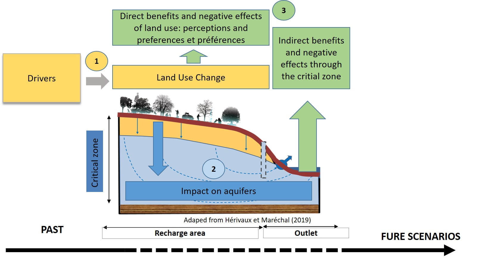
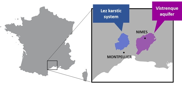
The French component of ABRESO seeks to understand the impact of land use dynamics, especially land abandonment, on the critical zone and to evaluate people preferences for land use change, in order to support the design of future land management plans by local authorities (Figure 1) in the Vistrenque and Lez Aquifers (Figure 2). The project is implemented by a team of economists and hydrogeologists of the French Geological Survey (BRGM) (https://www.brgm.fr/fr ) and Earth Observation specialists of Collecte Localisation Satellites (CLS) (https://www.cls.fr/). The implementation of the project will follow the following steps:
- Characterize land use dynamics and identify economic, policy and social drivers of these changes.
- Evaluate the impact of land use dynamics on groundwater resources (i.e., groundwater recharge and quality).
- Evaluate the perception and the preferences of inhabitants for the different land use types and their dynamics, using the identification of ecosystem services and disservices as a framework.
These activities will be implemented both for past land use dynamics and for future scenarios elaborated in a participatory process.
Figure 1: Conceptual scheme of the ABRESO project in France
Vistrenque Aquifers
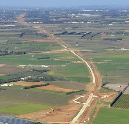
The territory of the Vistrenque aquifers has witnessed important land use change during the last decades including abandonment of agricultural land linked wine production and to the pressure of urban development with the addition of important infrastructures (LGV Nîmes Montpellier, Figure 3) and ecological compensation programs. These dynamics of land use can have effects on the water quality in drinking water catchments, on ecosystem function (e.g., this territory is one of the main habitats for the Little Bustard (Figure 4), a protected species), on ecosystem services (e.g. agricultural production, regulation of runoff and erosion, etc.) and on the development of possible negative effects (e.g. risk of fire).
Understanding the effect of these dynamics is essential for organizations in charge of water management and development on the territory (i.e., EPTB Vistre and Vistrenque, Nîmes Métropole), in order to design management measures to be implemented in the future to orient these land use dynamics.
Lez karstic system
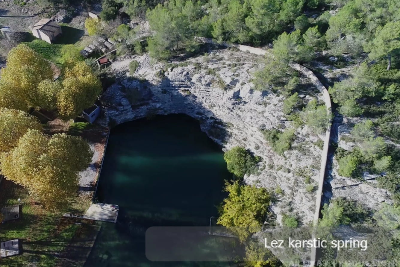
The Lez Spring impluvium (Figure 5) is marked by significant land use dynamics in the last decades including: abandonment of agricultural land due to the decline of livestock, urban development and wine production (Figure 6), as well as, thedynamics of recovery of wine growing in the last ten years with the development of the local wine protected designation of origin “Pic Saint Loup.” These land use dynamics have potential effects on the hydrogeochemical cycles of the Lez karstic system, notably on recharge, on ecosystem function and services, and on the development of possible negative effects (e.g. fire risk).
Figure 5: The Lez karstic Spring ©Artmax Production
Understanding the influence of these dynamics is essential for the institutions in charge of managing the territory (i.e., Montpellier Méditerranée Métropole, Syndicat du Bassin du Lez, Communauté de Communes du Grand Pic Saint Loup) in order to design measures to be implemented to orient these land use dynamics towards a sustainable groundwater management. This issue is particularly strategic since the Lez karst is the main resource for the drinking water supply of a population of more than 340,000 inhabitants. The impluvium of the Lez spring has also been defined as a safeguard zone to be protected for the supply of drinking water for present and future generations.
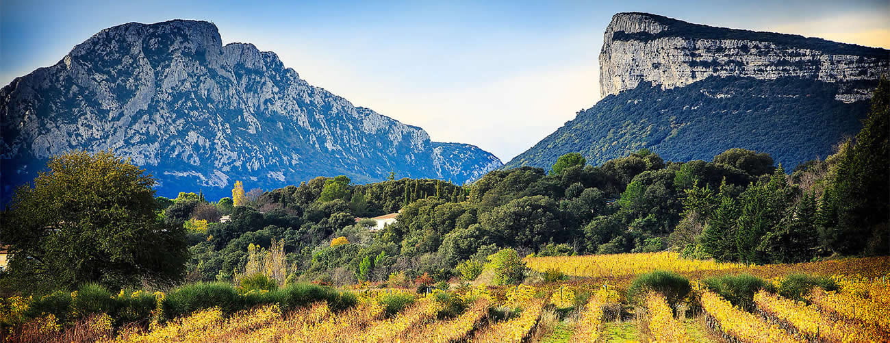
Figure 6: Vineyards in the Lez impluvium ©Antoine Naudet
Methods & Tools
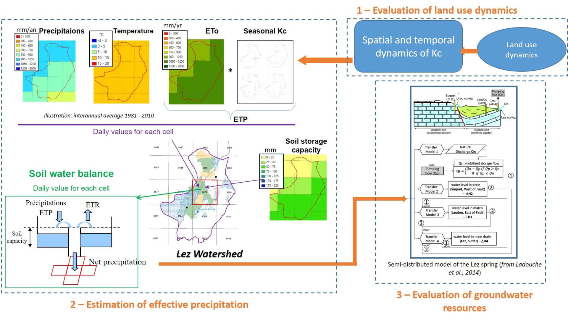
In order to assess the impact of land-use dynamics on the critical zone and on the associated services, existing tools developed by BRGM will be used to correlate land use changes with hydrological and biogeochemical dynamics in soil and water including ESPERE, PeffDayGrid and TEMPO to analyse changes in water flows (Figure 7) and the BICHE model to analyse changes in groundwater quality (nitrate).
Figure 7: Groundwater modeling in the Lez case study
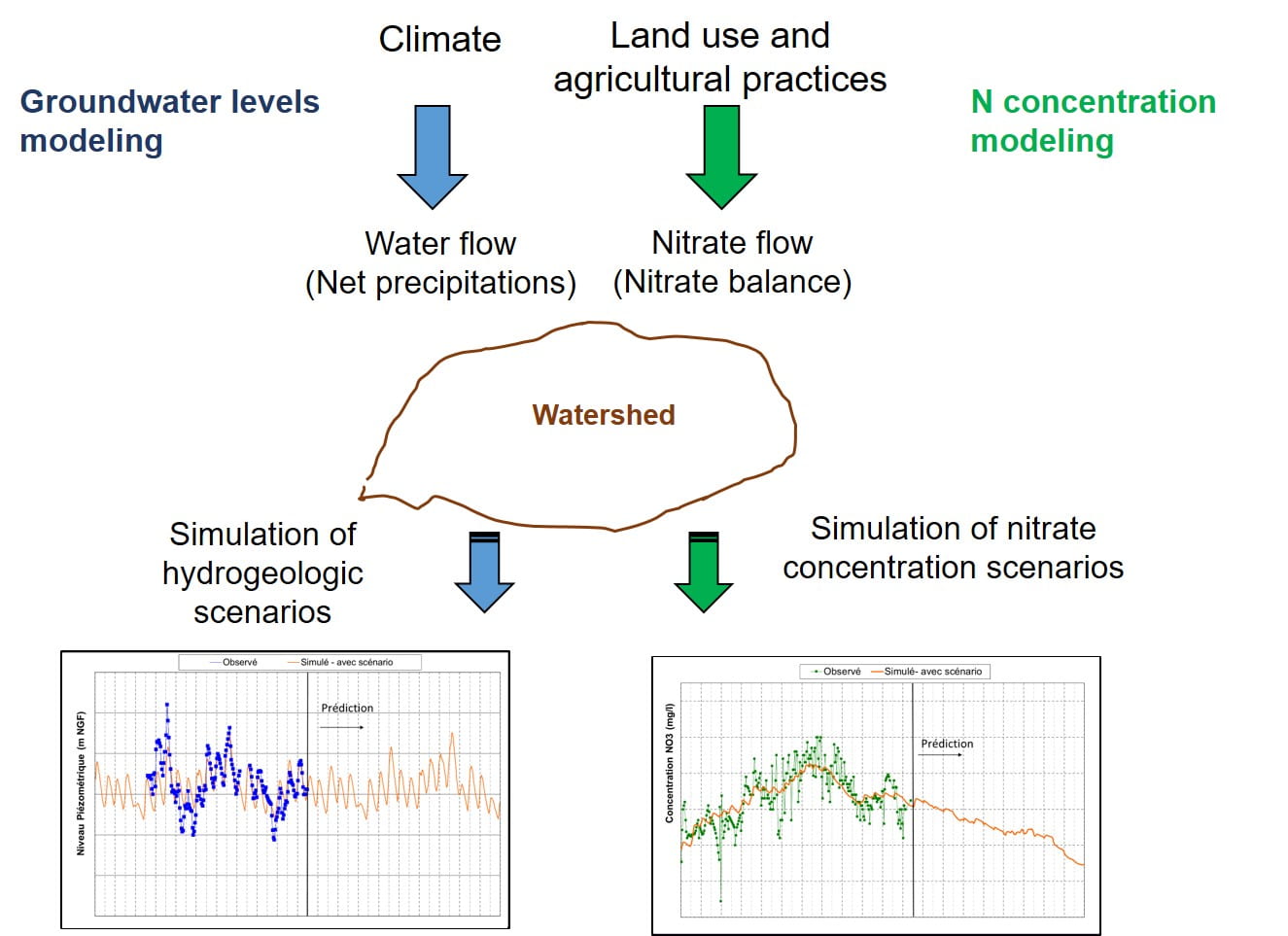
BICHE is a lumped model, which simulates nitrate transfer together with the hydrological functioning at the scale of a catchment. This model is designed to represent the processes governing catchment hydrology and water quality and is therefore a useful tool for catchment management (Figure 8).
Figure 8: Nitrate modeling principle for the Vistrenque case study
Stakeholders
A social science component will also be implemented in the French sites to evaluate the perception of past land use dynamics. Semi-directive interviews with local stakeholders will help to identify drivers of land use change and especially the phenomenon of land abandonment/redevelopment. The perception of ecosystem services and negative effects associated with this land abandonment/redevelopment will be assessed through qualitative interviews with land users and inhabitants of the watershed. Focus groups will evaluate the co-construction of future scenarios of land use change through quantitative surveys based on monetary and socio-cultural methods to evaluate the preferences for future scenarios of land use.
Additional Information
References
BLANK
2019
- Hérivaux, C., and Maréchal, J. (2019). Prise en compte des services dépendants des aquifères dans les démarches d’évaluation des services écosystémiques (Considering aquiferdependent services in ecosystem service valuation approaches). Technical report BRGM/RP-68929-FR. Project funded by the French Biodiversity Agency, ID : 10670/1.mgx7ln


