Italy
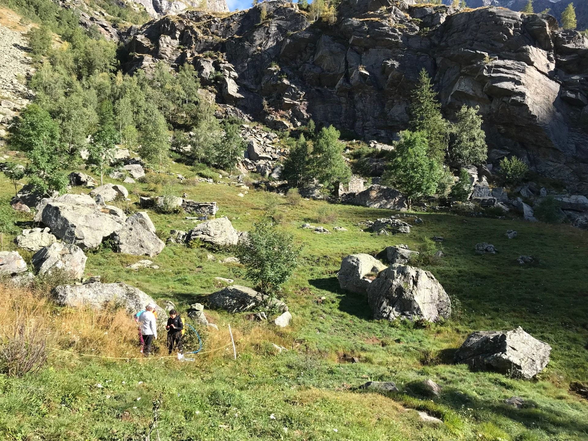
Since the 1960s, traditional practices of mountain grasslands and crop management – seasonal grazing, hay production and terrace cultivation – have been gradually abandoned in the lowland and valleys of the Italian Alps, causing reforestation in the western Alps, and the expansion of urban areas that increased the risk of contact between wild animals, livestock, and humans in the eastern Alps. Opportunities to counterbalance the land abandonment in the alpine sites of the ABRESO project could come from investigation of three study cases: Noaschetta and Val Grande (Piedmont Region), and Val Malene and Brocon (Trentino Region).
The Italian contribution to the project will be developed by four CNR Institutes (IGG-Pisa, IRET, IIA, IRCrES) in collaboration with the University of Pavia, Gran Paradiso National Park, Val Grande National Park, and UNCEM. Moreover, national and local stakeholders will help the evaluation of the effects of the perception of land use changes, including abandonment, and on the services associated with the ecosystems.
Field sites in the Italian Alps
In the eastern Alps, two sites located in the Tesino plateau and surrounding territories (Trento Region ofItaly) were considered in the project. The traditional seasonal grazing, alpeggio, has been carried out for centuries in these areas. Alpeggio takes advantage of mountain pasture productivity in summer; during this period animals are moved from the lowland for grazing to altitudes from 1000 to 2300-2500 m. While grazed territories have exhibited a substantial reduction in the last decades, alpeggio practice continues in a reduced form in isolated patches surrounding the mountain farms. The pasture’s management is carried out by farmers who rent these lands from the local authorities.
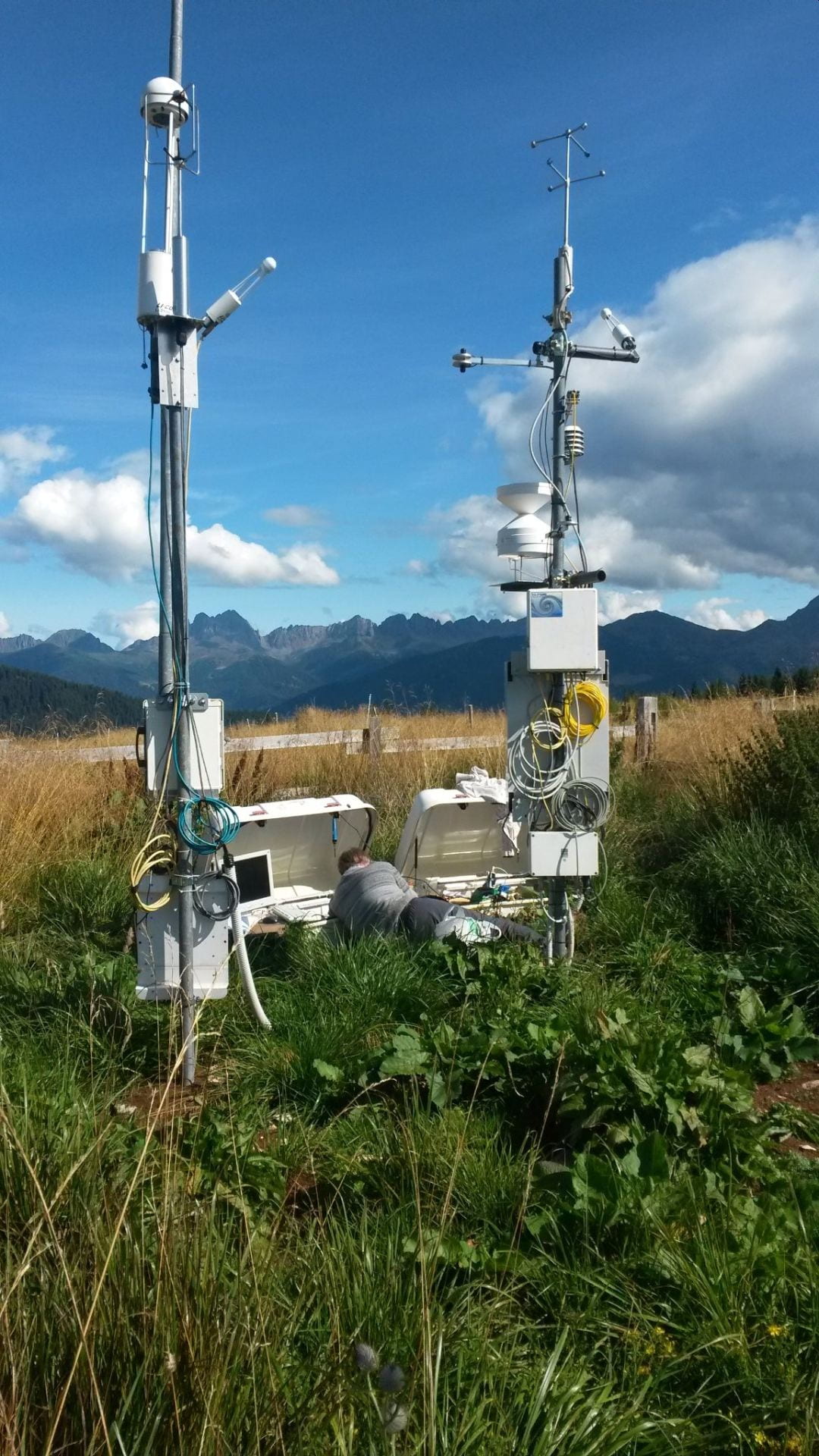
Brocon (Municipality of Cinte Tesino, Italy). The site is equipped with an eddy covariance tower for continuous measurements of gas exchange of CO2 and H2O.
The first site, Brocon (Municipality of Cinte Tesino) is located close to the Brocon Pass at 1730 m asl (46°06’50 N 11°42’13 E). Malga Arpaco is the closest farm, where cattle are present starting from the beginning of June till September. Milk and cheese are produced at this time and sold to the visitors and tourists. The site is equipped with an eddy covariance tower for continuous measurements of gas exchange of CO2 and H2O between the ecosystem and the atmosphere. Sampling of plant and soil material is performed in patches characterized by different grazing pressure and in the spruce forest surrounding the pasture.
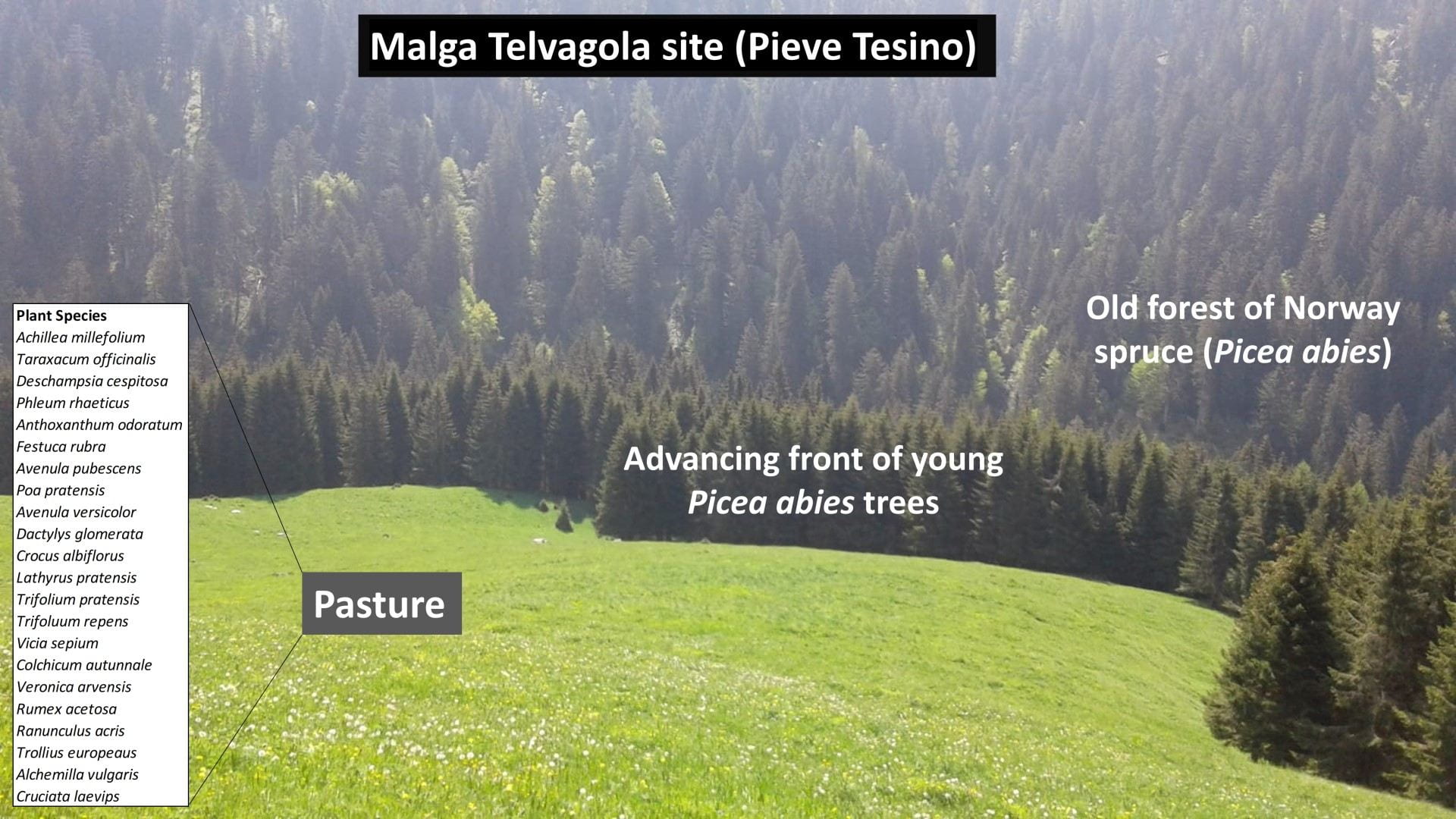
The second site, Malga Telvagola (Municipality of Pieve Tesino) is located between the Brocon pass and the Valmalene at 1592 m asl (46°07’03.9 N 11°38’37.5 E) and is characterized by the presence of an alpine farm recently renewed with an active pasture where Braunvieh and Grauvieh cattle graze the grass of the large meadow. A spruce forest (Picea abies) surrounds the meadow and is progressively re-colonizing the grazing area. A transept from the grazed area to the old spruce forest has been selected and used to study the environmental and socio-economic impacts of land use change (from pasture to forest) in the Alpine environment.
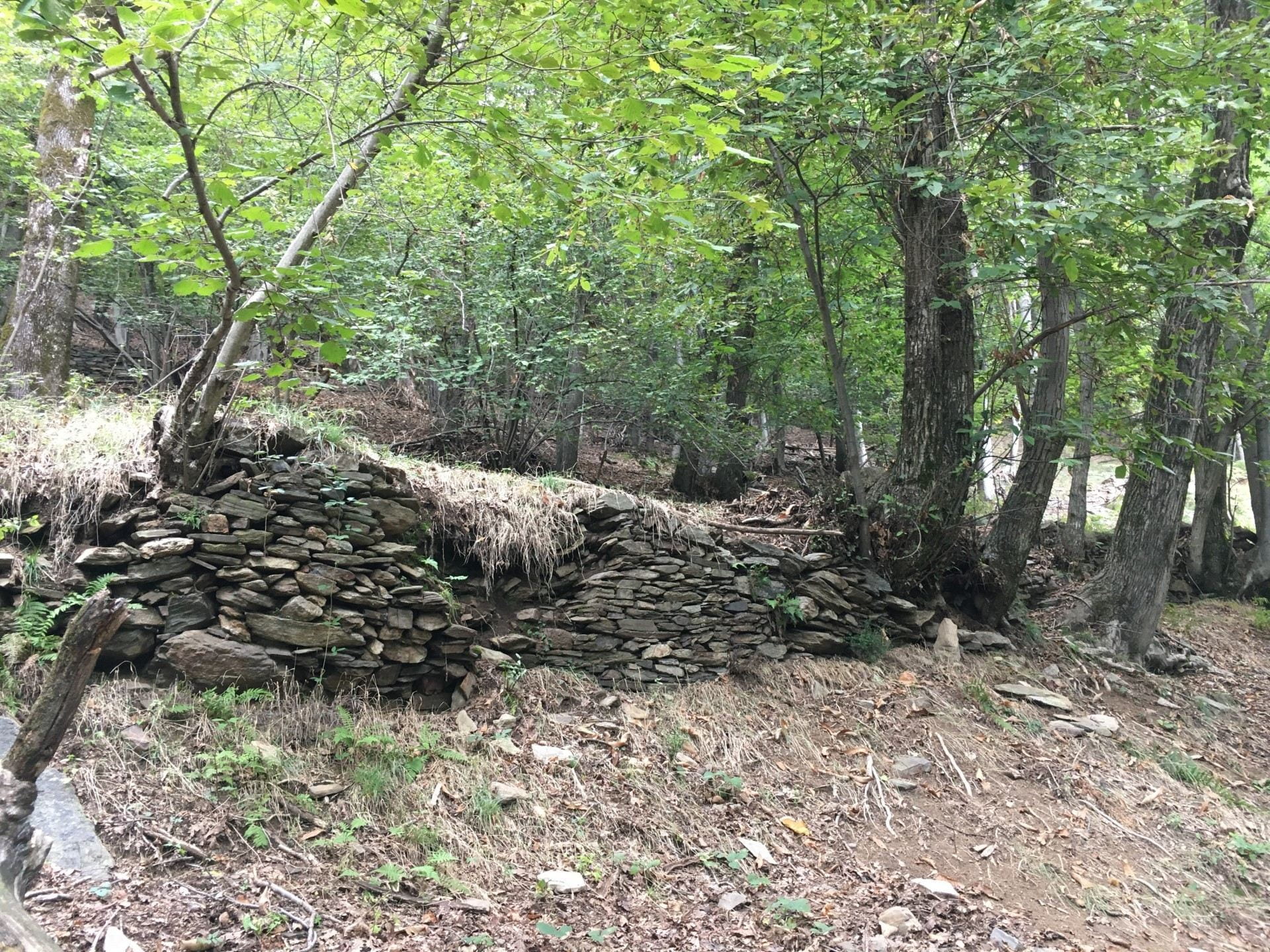
In the western Alps, the site of Val Grande National Park (Piedmont Region, Italy) has been selected for the project. Val Grande National Park is the largest wilderness area in Italy. The mean annual precipitation reaches 2000 mm. However, extreme precipitation events, like the one registered in October 2019 (19-24-10), can reach over 600 mm in just one day. Concerning the land use only small and sparse villages are present within the area. Traditional terraced agricultural practices and pastures were abandoned after WWII and most of these slopes have since been colonized by forests. Four different land uses have been identified: abandoned pastures, abandoned pastures occupied by forests, Fagus forests, and chestnut groves.
The sites will also be studied through Earth observation techniques: changes that have occurred due to land abandonment and climate change will be detected by means of the analysis of time series of satellite data.
Water-Soil-Vegetation Interactions
Perception of Land Management
As well as natural processes, land management and socio-cultural changes create transitions that stakeholders and inhabitants may be unlikely to understand. However, these changes influence stakeholders and their acceptance of land use policies and land management strategies. The overall theme is to identify the relationship between observable and perceived effects of land use transitions on the critical zone. Observable effects include biogeochemical cycles triggered by changes in land use and land management strategies. Perceived effects include stakeholder expectations, preferences, perceptions of nature and valuation of ecosystem services and disservices.
By integrating quantitative and qualitative socio-economic methodologies of analysis, we will investigate how heterogeneity in perceptions depends on stakeholder characteristics (e.g., urban vs. rural, resident vs. visitor, etc.), as well as changes characterize across different spatial and time scales. Finally, we will examine the relationship between perceptions and spatial management decisions.
Additional Information
References
BLANK
2021
- Fazzini, P.; De Felice Proia, G.; Adamo, M.; Blonda, P.; Petracchini, F.; Forte, L.; Tarantino, C. (2021). “Sentinel-2 Remote Sensed Image Classification with Patchwise Trained ConvNets for Grassland Habitat Discrimination”, Remote Sensing, Special Issue “Deep Learning for Remote Sensing Image Classification”, 13(12), 2276. https://doi.org/10.3390/rs13122276
- Tarantino, L. Forte, P. Blonda, S. Vicario, V. Tomaselli, C. Beierkuhnlein, M. Adamo. (2021). “Intra-Annual Sentinel-2 Time-Series Supporting Grassland Habitat Discrimination”, Remote Sensing, Special Issue “Remote Sensing for Habitat Mapping”, 13(2), 277, ISSN: 2072-4292, https://doi.org/10.3390/rs13020277
- Morganti, J. G. Cecere, S. Quilici, C. Tarantino, P. Blonda, M. Griggio, R. Ambrosini, and D. Rubolini. (2021). “Assessing the relative importance of managed crops and semi-natural grasslands as foraging habitats for breeding lesser kestrels Falco naumanni in southeastern Italy”, Wildlife Biology, 2021(1), https://doi.org/10.2981/wlb.00800
- Richiardi, C.; Blonda, P.; Rana, F.M.; Santoro, M.; Tarantino, C.; Vicario, S.; Adamo, M. A Revised Snow Cover Algorithm to Improve Discrimination between Snow and Clouds: A Case Study in Gran Paradiso National Park. Remote Sens. 2021, 13, 1957. https://doi.org/10.3390/rs13101957
- Rocchini, D., Thouverai, E., Marcantonio, M., Iannacito, M., Da Re, D., Torresani, M., Bacaro, G., Bazzichetto, M., Bernardi, A., Foody, G. M., Furrer, R., Kleijn, D., Larsen, S., Lenoir, J., Malavasi, M., Marchetto, E., Messori, F., Montaghi, A., Moudrý, V., … Wegmann, M. (2021). rasterdiv—An Information Theory tailored R package for measuring ecosystem heterogeneity from space: To the origin and back. Methods in Ecology and Evolution, 12(6), 1093–1102. https://doi.org/10.1111/2041-210X.13583
2020
- Magnani M., Baneschi I., Giamberini S., Mosca P., Raco B. Provenzale A. Drivers of carbon fluxes in Alpine Tundra: a comparison of three empirical model approaches. 2020. Sc Tot. Env. 732, 139139
- Maria Adamo, Valeria Tomaselli, Cristina Tarantino, Saverio Vicario, Giuseppe Veronico, Richard Lucas and Palma Blonda, “Knowledge-based classification of (semi)natural grasslands based on multi-temporal WorldView-2 data and FAO-LCCS taxonomy”, Remote Sensing, 2020, 12(9), 1447; https://doi.org/10.3390/rs12091447
- Saverio Vicario, Maria Adamo, Domingo Alcaraz-Segura and Cristina Tarantino (2020). “Bayesian harmonic modelling of sparse and irregular satellite remote sensing time series of vegetation indexes: a story of clouds and fires”, Remote Sensing, 12(1), https://doi.org/10.3390/rs12010083
2019
- Scartazza A., et al., Investigating the dynamics of plant -soil relationship in Alpine meadows of Gran Paradiso National Park. Ecopotential Project meeting, 2019.
- Gavrichkova, O., M. Galvagno, E. Brugnoli, T. Chiti, E. Cremonese, G. Filippa, M. Mattioni, U. Morra di Cella, C. Calfapietra (2019). Carbon fluxes in Alpine grasslands. In: Climate and environmental changes in the Italian mountains. Ed. Donato & Palazzi ISBN 9788879580489
- Gavrichkova, O., G.Pretto, A.Scartazza, T.Chiti, M.Mattioni, M.C.Moscatelli, R.Pini, C.Calfapietra (2019). Effects of grazing and its cessation on aboveground and belowground functioning of alpine grasslands. In: Climate and environmental changes in the Italian mountains. Ed. Donato & Palazzi ISBN 9788879580489
- Gavrichkova, O., Pretto, G., Scartazza, A., Chiti, T., Mattioni, M., Moscatelli, M.C., Pini, R. and Calfapietra, C., 2019, January. Why soils are losing C after grazing abandonment? Effects of traditional pastoral activity on soil biochemical properties. In Geophysical Research Abstracts (Vol. 21).
- Tarantino, F. Casella, M. Adamo, R. Lucas, C. Beierkuhnlein, P. Blonda. (2019). “Ailanthus altissima mapping from multi-temporal very high resolution satellite images”, ISPRS Journal of Photogrammetry and Remote Sensing, ISSN: 0924-2716, 147, 90-103, https://doi.org/10.1016/j.isprsjprs.2018.11.013
2018
- Gavish, J. O’Connel, C.J. Marsh, C. Tarantino, P. Blonda, V. Tomaselli, W.E. Kunin. (2018). “Comparing the performance of flat and hierarchical Habitat/Land-Cover classification models in a NATURA 2000 site”, ISPRS Journal of Photogrammetry and Remote Sensing, 136, 1-12, https://doi.org/10.1016/j.isprsjprs.2017.12.002
2017
- Provenzale A., Beierkuhnlein C., Giamberini M., Pennisi M., Puglisi G. Volcanic supersites as cross-disciplinary laboratories. 2017. Vol 19, EGU2017-10277
- Niphadkar, M., Nagendra, H., Tarantino, C., Adamo, M., & Blonda, P. (2017). Comparing Pixel and ObjectBased Approaches to Map an Understorey Invasive Shrub in Tropical Mixed Forests. Frontiers in Plant Science, 8.
- Tomaselli, V., Adamo, M., Veronico, G., Sciandrello, S., Tarantino, C., Dimopoulos, P., Medagli P., Nagendra H. & Blonda, P. (2017). “Definition and application of expert knowledge on vegetation pattern, phenology, and seasonality for habitat mapping, as exemplified in a Mediterranean coastal site”. Plant Biosystems-An International Journal Dealing with all Aspects of Plant Biology, 151(5), 887-899. doi: 10.1080/11263504.2016.1231143
2016
- Tarantino, F. Lovergine, M. Niphadkar, R. Lucas, S. Nativi, P. Blonda. (2016). “Towards Operational Detection of Forest Ecosystem Changes in Protected Areas”, Remote Sensing, October 2016, 8(10), 850, ISSN: 2072-4292, doi: 10.3390/rs8100850
- Tarantino, M. Adamo, R. Lucas, P. Blonda. (2016). “Detection of changes in semi-natural grasslands by cross correlation analysis with Worldview-2 images and new Landsat 8 data”, Remote Sensing of Environment, Vol. 175C, pp. 65-72, ISSN: 0034-4257, https://doi.org/10.1016/j.rse.2015.12.031
- Adamo, M., Tarantino, C., Tomaselli, V., Veronico, G., Nagendra, H. and Blonda, P. (2016), “Habitat mapping of coastal wetlands using expert knowledge and Earth observation data”. J Appl Ecol. doi: 10.1111/1365- 2664.12695. Online ISSN: 1365-2664. IF: 5.196.
- Adamo, M., Tarantino, C., Tomaselli, V., Veronico, G., Nagendra, H. and Blonda, P. (2016), “Habitat mapping of coastal wetlands using expert knowledge and Earth observation data”. J Appl Ecol. doi: 10.1111/1365- 2664.12695. Online ISSN: 1365-2664. IF: 5.196.
2015
- Z.I. Petrou, I. Manakos, T. Stathaki, C.A. Mucher and M. Adamo, “Discrimination of vegetation height categories with passive satellite sensor imagery using texture analysis”, IEEE Journal of Selected Topics in Applied Earth Observations and Remote Sensing (JSTARS), doi: 10.1109/JSTARS.2015.2409131, Vol. 8, No. 4, pp. 1442 – 1455, 2015. ISSN: 1939-1404. IF: 3.026.
- Lucas, P. Blonda, P. Bunting, G. Jones, J. Inglada, M. Arias, V. Kosmidou, Z.I. Petrou, I. Manakos, M. Adamo, R. Charnock, C. Tarantino, C.A. Mücher, R. Jongman, H. Kramer, D. Arvor, J, Pradinho Honrado and Paola Mairota, “The Earth Observation Data for Habitat Monitoring (EODHaM) System”, Int. J. Appl. Earth Observ. Geoinf., Vol. 37, pp. 17-28, (2015), doi: 10.1016/j.jag.2014.10.011. ISSN: 0303-2434. IF: 3.47.
- C.A. Mücher, L. Roupioz, H. Kramer, M. Wolters,M. Bogers, R. Jongman, R. M. Lucas, P. F. Bunting, V. Kosmidou, Z. Petrou, I. Manakos, E. Padoa-Schioppa, G. F Ficetola, M. Adamo, P. Blonda, “Synergy of airborne LiDAR and Worldview-2 satellite imagery for land cover and habitat mapping: A BIO SOS-EODHaM case study for the Netherlands”. Int. J. Appl. Earth Observ. Geoinf., Vol. 37, pp. 48-55 (2015), doi: 10.1016/j.jag.2014.09.001. ISSN: 0303-2434. IF: 3.47.
2014
- Maria Adamo, Cristina Tarantino, Valeria Tomaselli, Vasiliki Kosmidou, Zisis Petrou, Ioannis Manakos, Richard M. Lucas, Casper A. Mucher, Giuseppe Veronico, Carmela Marangi, Vito De Pasquale and Palma Blonda, “Expert knowledge for translating land cover/ use maps to General Habitat Categories (GHCs)”, Landscape Ecology, 29(6), 1045- 1067, doi: 10.1007/s10980-014-0028-9, 2014. ISSN: 0921-2973 (print) 1572-9761 (electronic). IF: 3.5
- Petrou, Z.I., Kosmidou, V., Manakos, I., Stathaki, T., Adamo, M., Tarantino, C., Tomaselli, V., Blonda, P, Petrou, M.. A rule-based classification methodology to handle uncertainty in habitat mapping employing evidential reasoning and fuzzy logic. Pattern Recogn. Lett. Vol. 48, pp. 24-33, 2014. doi: 10.1016/j.patrec.2013.11.002. ISSN: 0167-8655. IF: 1.551.


